Речка Чёрная, вид с причала

Adventist church in Efendiköy (Aivove) village

View on the Qaça Valley

Черноморский флот под покровом ночи

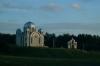
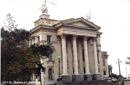
Town hall in Duvanköy (Verkhn'osadove) village

Вид на Учкуевку

36740064.jpg

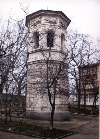
Памятник в Врхне-Садовом

Sewage works near Liubymivka

View on the Qaça Valley

Latitude 44°44'52.90"N: The Qaça Valley

Monument to British warriors fallen in the Crimean War of 1853-56

Вид с балкона (пр. Победы)

46548023.jpg

Old house in Qamışlı (Kamyshly) village

с. Штурмовое

Billabong in Eski Eli (Vyshneve) village

The Belbek River mouth

Fields by the Qaça River

Distant view on a lighthouse in Inkerman

Old mulberry tree in Efendiköy (Aivove) village

View on the Qaça Valley

Road in the Çorğuna River Valley

Seashore in Mamaşay

Latitude 44°44'52.90"N: The Qaça Valley

The Çorğuna River

Qamışlı (Kamyshly) village

Distant view on a pond and a railroad bridge

Road in the Qaça Valley in winter

Road in the Qaça Valley near Gölümbey (Nekrasovka) village

Road from Sieverna to Mamaşay (Orlivka) village

Far-off Sevastopol at sunset

Sevastopol to Yevpatoriia Hwy near the Belbek Airpt

View on Belbek (Fruktove) village

Road from Upa (Ridne) village to the Şüli Valley

Peach gardens and hills in the Qaça Valley

Latitude 44°44'52.90"N: The Qaça Valley

Small lake on the Liubymivka beach

63411014.jpg

Sevastopol

Latitude 44°44'52.90"N: The Qaça Valley

The Qaça River

Storehouses nearby the Calamita Fortress

Rocks in the Qaça Valley

Road in Qamışlı Gulch

Building of the Local Council in Qalımtay (Tinyste) village

Latitude 44°44'52.90"N: The Qaça Valley

Old house in Qamışlı (Kamyshly) village
Photos provided by Panoramio. Photos are under the copyright of their owners.